Featured Post

My Expedition Vehicle & Trailer

Tuesday, December 22, 2015

Expedition Trailer At Coyote Flat

Coyote Flat is one of those great camping areas that offers a scenic remote experience in the Inyo National Forest with amazing views in all directions. Located near Bishop California, much of the Flat is at 10,000 feet or above. Plenty of interesting history rounds out the appeal from mining and ranching to a long abandoned US Army airfield. The natural beauty is a mix of lakes, forests, streams and meadows. Motorized visitors need to stay on the trails and note that some are difficult to follow so consult maps, satellite photos and bring a GPS too.


I drove in from Bishop and the initial switchbacks provide quite an experience with steep drop-offs to the side and some mildly challenging poor traction areas. I would not want to attempt this route with or without my trailer if the trail was wet or icy. Otherwise a good 4WD with low gears, decent ground clearance and appropriate tires will do fine.

The time of year can make quite a difference in what you may see. Because of the presence of Aspens you might have a chance to see some nice color amidst the stands of pine. In the distance you can see the Palisades Glacier. All of the forest fires made the air too hazy for good shots of the Sierras.

Many of the lakes receive water from either rain or snow melt so the prolonged drought has forced many of them to dry up. In fact, Rocky bottom Lake clearly does have a base that is well matched to its moniker. In this picture it is far below me and decidedly bone dry.

Despite the low water level Funnel Lake still offered great reflections on the still surface.

It was also a great view of Funnel Lake from the camp site that I chose.


 A telephoto shot of camp from the cliff above the lake


Sunsets were never a disappointment!


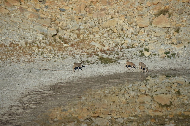
Every morning and evening some deer would come down to the lake to slake their thirst and nibble on small bits of vegetation.

The lake's reflection of the rocky shores made it hard to tell if the deer were really drinking water


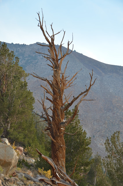
Near the tree line some of the older trees offer quite a tortured exterior that reflects the weather that both nurtures and possibly destroys them


This forlorn tree trunk reminded me of a headless Greek statue with one arm raised in greeting.

This is an area worth visiting for four or more days. I used one day to drive on the truck trails over to Baker Creek and then enjoyed a leisurely  hike up to the Baker Lake

In the main area of Coyote Flat there was once a small military airfield:

 http://www.airfields-freeman.com/CA/Airfields_CA_Fresno_N.htm#coyoteflats

At 9988’ above sea level, Coyote Flat was the highest airfield in North America until its recent de-comissioning and is one of the few military installations to have been based in the Owens Valley and immediate surroundings. In the 1960s, the Air Force Flight Center, Edwards Air Force base (AFFTC) took over 642 acres of Coyote Flat as a test site. The official explanation is that the Department of Defense used the landing strip to test the high altitude performance of helicopters and airplanes. More conspiracy minded individuals point out that AFFTC also ran Area 51 and that the inaccessibility of Coyote Flat kept operations far from prying eyes. In the last few years, control of the area was ceded back to the Forest Service which removed the three buildings, dug up the pavement, and surrounded the site with barbed wire in order to return the site to its natural condition. The Forest Service insists that the large “X” is meant to discourage landings. Even so, back country flying enthusiasts have found it possible to land on the airstrip without undo trouble.

I appreciate your visit to my blog! I hope that these write ups of mine will inspire you to seek out your own adventures. Fare well until we next meet.


Monday, December 21, 2015

Lost Tunnels Of The Angeles National Forest

Come along on a trip back in time, back to the 1950s when the Cold War was a dominant theme and the fear of Communism altered the landscape of Southern California.


Southern California was home to a large system of air defense missiles, installed and operated by the US Army. Many of the Nike missile bunkers can still be found.

Once a month children would practice "Duck & Cover" exercises when the air raid sirens were tested.

The Civil Defense Administration published many sorts of manuals on everything from constructing a home fallout shelter to how you should drive away from a target zone of a nuclear strike.

Los Angeles was considered a likely target of a Soviet attack and the LA County Road Department engaged in a number of projects to move more people out of the city in an emergency.  One such highway project was in Shoemaker Canyon. Initiated in 1954 it would drag on for 15 years with the road's end never making a connection to the Angeles Crest Highway. Only 4.5 miles were finished in the forbidding terrain with a halt to construction finally called in 1969.

This canyon was named for the prospector Alonzo Shoemaker who worked in the East Fork area during the 1870's to1880's.

Getting ready to switch from my 4WD to my trusty 1WD

The engineers designed many deep cuts into the rugged terrain in order to provide a modest grade for cars to climb.


As you hike or ride along be sure to watch for artifacts of the construction project


Before too long I could just see the dark opening of Tunnel #1!


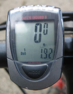
Just 1.74 miles to travel back to 1961!


Just 0.18 miles to the other end of the tunnel

A peek inside

And a look at the north end.

 In the distance I can just see Tunnel #2


More nicely graded road to follow

The skies are starting to darken.

Soon the north end of that tunnel is a ways behind me.

The north exit of Tunnel #1 is nestled in the folds of the steep terrain.


Along the walls of the grade I spot some old water pipe that linked various storage tanks

At 2.62 miles I made it to the entrance of Tunnel #2


Tunnel #2 was marked with "1964" but the concrete has been badly damaged by what appears to be rifle shots. The interior is not as well finished as Tunnel #1 with exposed rebar awaiting the pouring of concrete for the lower walls.

Some areas of the tunnel roof were solid enough to forgo any reinforcement. It must have been difficult to blast and remove so much rock.
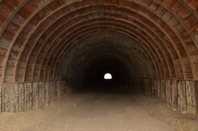
Looking back out the entrance gives a nice highlight to the steel roof.

Only 0.12 miles to the end.


Made it!

An old water tank will eventually tumble down the eroded ravine if it is not stabilized soon.

The trail quickly disintegrates from a wide road into a barely visible footpath as it heads around the next slope.

The clouds continued to pile up so I cut the day short and made the downhill ride in about 10 minutes. I hope that you enjoyed this trek back in time and that you'll continue to enjoy my adventures too.