


Once a month children would practice "Duck & Cover" exercises when the air raid sirens were tested.

The Civil Defense Administration published many sorts of manuals on everything from constructing a home fallout shelter to how you should drive away from a target zone of a nuclear strike.

Los Angeles was considered a likely target of a Soviet attack and the LA County Road Department engaged in a number of projects to move more people out of the city in an emergency. One such highway project was in Shoemaker Canyon. Initiated in 1954 it would drag on for 15 years with the road's end never making a connection to the Angeles Crest Highway. Only 4.5 miles were finished in the forbidding terrain with a halt to construction finally called in 1969.

Getting ready to switch from my 4WD to my trusty 1WD

The engineers designed many deep cuts into the rugged terrain in order to provide a modest grade for cars to climb.

As you hike or ride along be sure to watch for artifacts of the construction project


Before too long I could just see the dark opening of Tunnel #1!

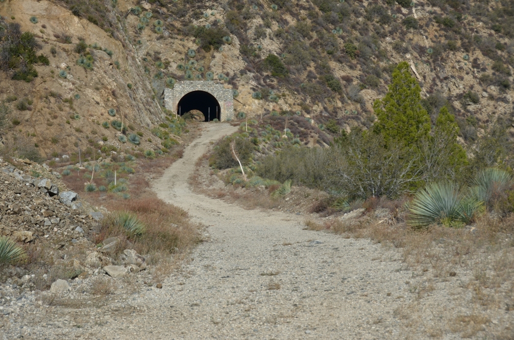
Just 1.74 miles to travel back to 1961!


Just 0.18 miles to the other end of the tunnel

A peek inside

And a look at the north end.

In the distance I can just see Tunnel #2

More nicely graded road to follow

The skies are starting to darken.

Soon the north end of that tunnel is a ways behind me.

The north exit of Tunnel #1 is nestled in the folds of the steep terrain.


Along the walls of the grade I spot some old water pipe that linked various storage tanks

At 2.62 miles I made it to the entrance of Tunnel #2


Some areas of the tunnel roof were solid enough to forgo any reinforcement. It must have been difficult to blast and remove so much rock.

Looking back out the entrance gives a nice highlight to the steel roof.

Only 0.12 miles to the end.

Made it!

An old water tank will eventually tumble down the eroded ravine if it is not stabilized soon.

The trail quickly disintegrates from a wide road into a barely visible footpath as it heads around the next slope.

The clouds continued to pile up so I cut the day short and made the downhill ride in about 10 minutes. I hope that you enjoyed this trek back in time and that you'll continue to enjoy my adventures too.

An excellent little history lesson, thank you! We have a similar, never completed, road in our area. To folks who are aware of it and its history, it is known as the Civil Defense Road. One of my childhood memories is my father loading up the family in the station wagon and driving up to the Wrightwood area to see the flash of an above ground test in Nevada. I will never forget that or those cold war times.
ReplyDeleteAwesome write up.
ReplyDeleteEnjoyed that walk through history, makes me want to look into something similar here in W.T.
ReplyDelete